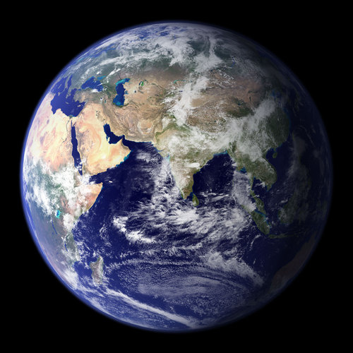
This spectacular “blue marble” image is the most detailed true-color image of the entire Earth to date. Using a collection of satellite-based observations, scientists and visualizers stitched together months of observations of the land surface, oceans, sea ice, and clouds into a seamless, true-color mosaic of every square kilometer (.386 square mile) of our plane.
Check out the gallery below to see an additional shot with the US of A front and center. Head over to NASA to download the larger, high resolution versions of these images. They make for a great desktop background.

